Profile
Sam Gandhi
-
About Me:
I recently moved from Cambridge to Bath, where I work as a Freelance Geographer. I enjoy playing football and tennis, flying my drone (for work and for pleasure), and running park runs around the country with my partner!
-
My pronouns are:
He/him
-
How I use Geography in my work:
Geography is my work! I run my own company called The Jolly Geographer, in which I provide geospatial consultancy services. This involves me mapping or studying the location of features of interest in the natural or built environment, following a significant event such as a hurricane, or just to understand where they are.
-
My Work:
I map features of interest to understand where they are, or how their location changes following a significant event such as a hurricane.
-
Read more
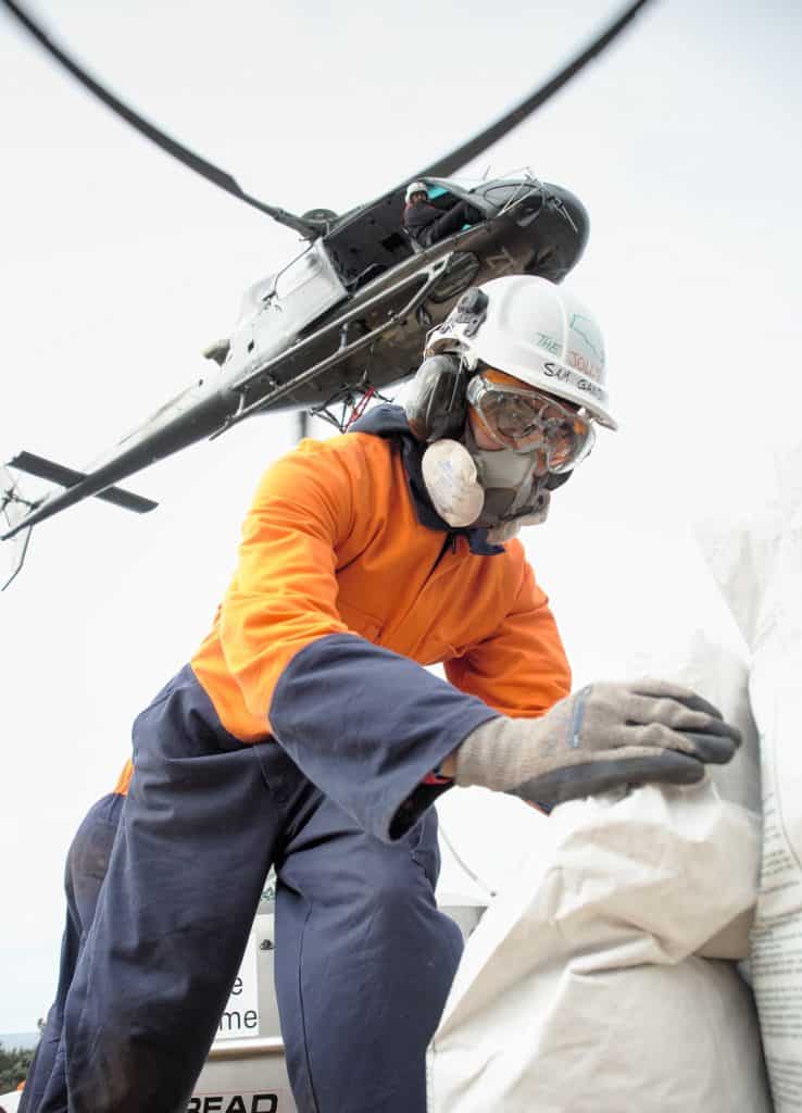
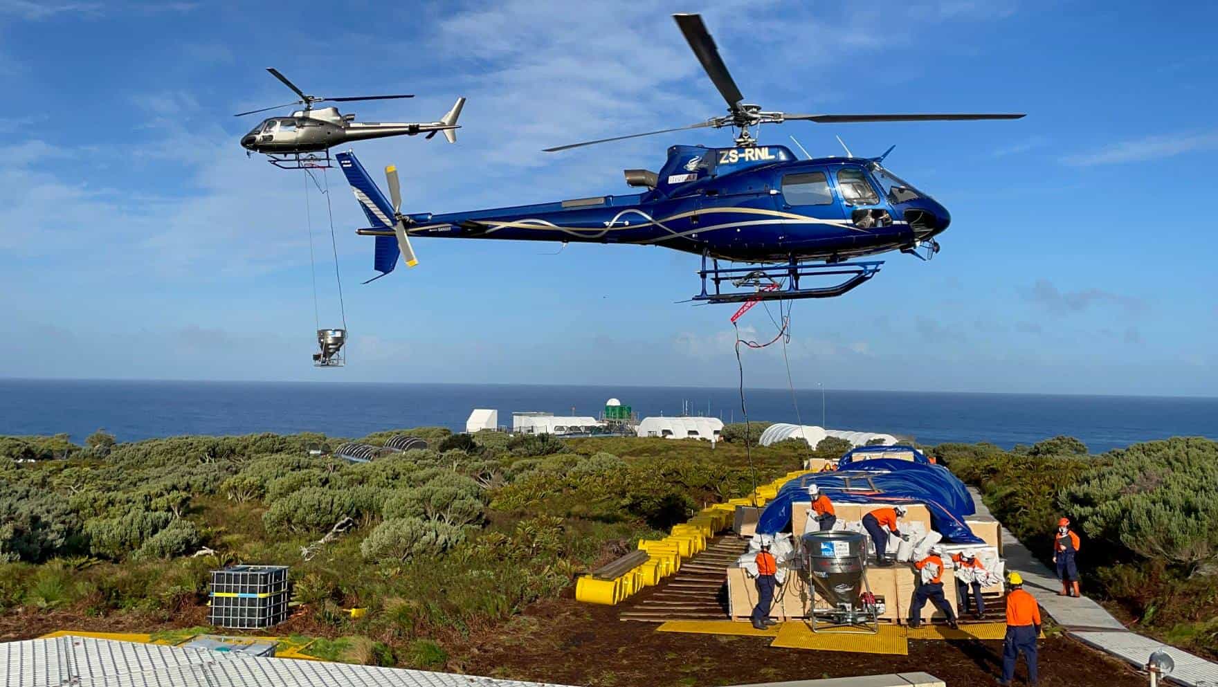
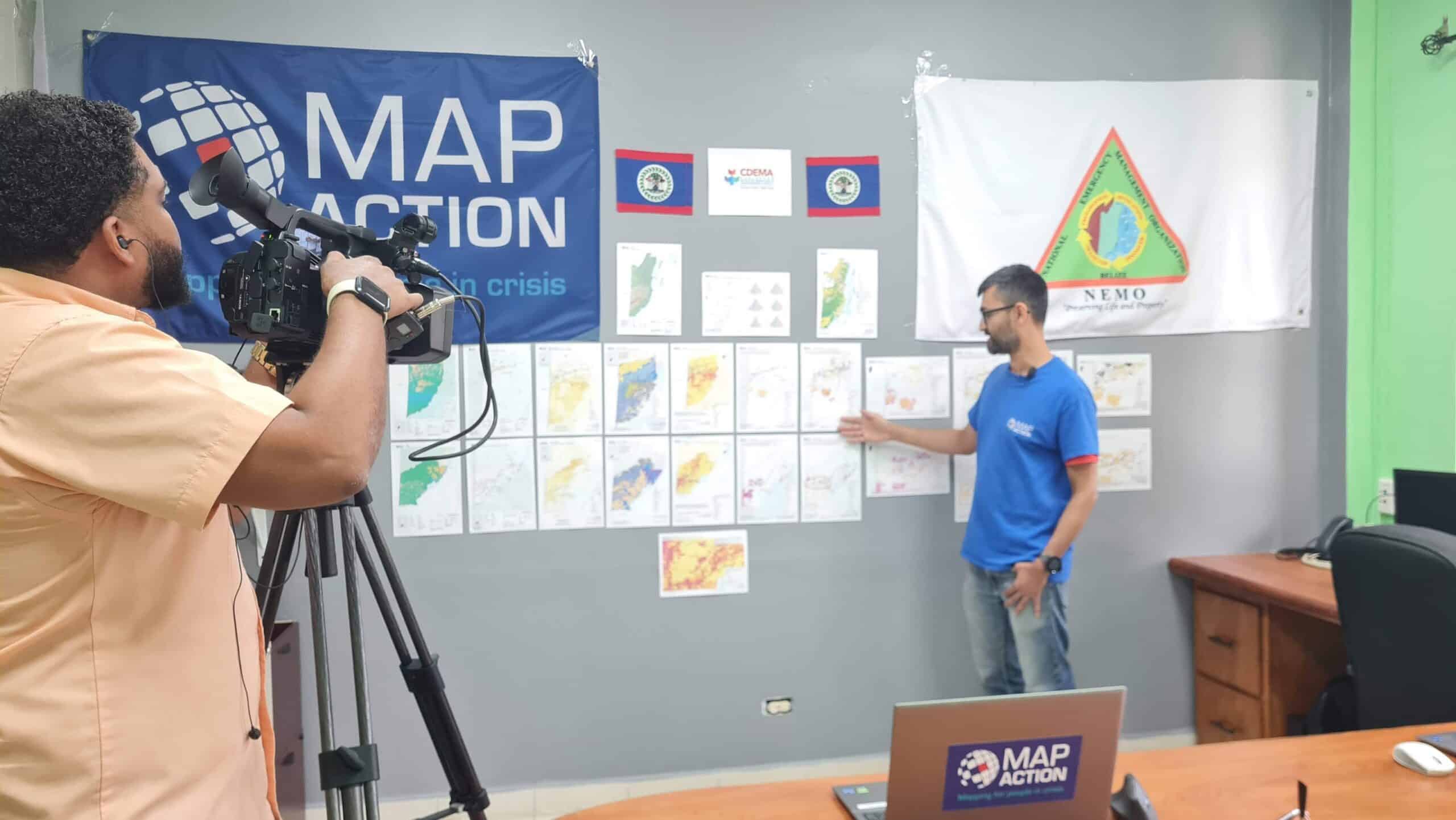
I love exploring my local area and new places further afield. There’s always something new to see. I love making maps, whether using data I’ve collected in the field (e.g. GPS tracks), or imagery taken with my drone, and combining it with data from agencies like NASA or Ordnance Survey. I use these skills as a volunteer at MapAction, which is a great humanitarian charity which deploys Geographers to map disaster zones soon after impact. MapAction’s maps are important to support first response teams from the UN, or charities such as Oxfam and the Red Cross.
-
My Typical Day:
As a Freelance Geographer my days are quite varied. I am my own boss, so I have to be disciplined. A typical day involves walking the dogs at 7.30am, starting work at 9am, staying in the office or heading into the field for a few hours until I finish for the day at around 5 or 6pm.
-
Read more
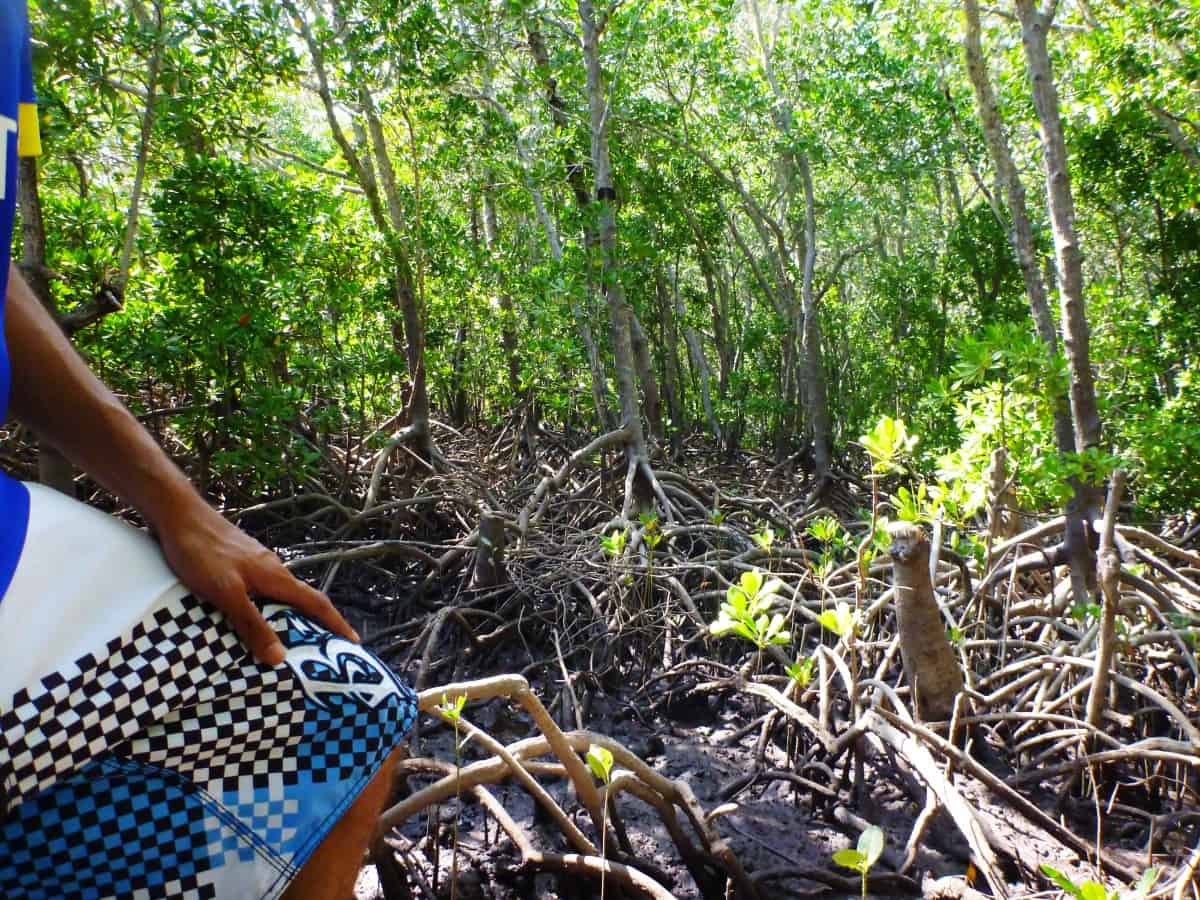
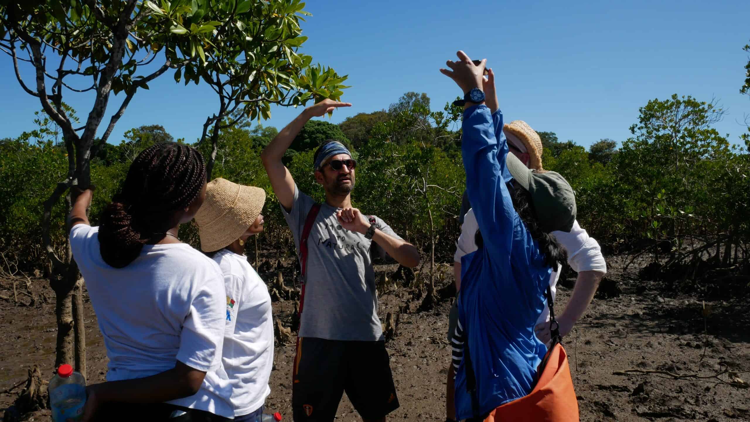
I sometimes need to plan fieldwork missions to see the features I am mapping with my own eyes. This can mean 2 week trips to Africa to see the mangroves I am mapping using satellite imagery.
-
What I'd do with the prize money:
I’d create an engaging video reel of satellite imagery showing some of the most spectacular landscapes on planet Earth, and put it on my website / visit local schools to explain how satellite imagery is important for lots of types of analysis, and the sorts of jobs students can aim for in Geography using satellite imagery.
-
Education:
Western Primary School, Harrogate, North Yorkshire (1992-1998)
Parmiter’s Secondary School, Watford, Hertfordshire (1999-2006)
London School of Economics to study an undergraduate degree in Geography (2006-2009)
King’s College London to study an environmental Masters degree
-
Qualifications:
11 A*-C GCSEs
4 A-Levels (Geography, Economics, Maths, IT)
BA Geography (Upper Second Class) from London School of Economics
MSc Environmental Monitoring, Modelling & Management from King’s College London
-
Work History:
2014-2019: Geospatial Intelligence Analyst, National Centre for Geospatial Intelligence, Ministry of Defence
2019-2021: Covid Data Analyst, Department for Environment, Food & Rural Affairs
-
Current Job:
2019-present: Founder and Director of The Jolly Geographer Ltd
2021-present: deployable GIS volunteer at MapAction
-
Employer:
Myself! I run my own business: The Jolly Geographer Ltd
-
My Interview
-
What did you want to be after you left school?
A conservationist
Were you ever in trouble at school?
Only for talking too much in class!
If you weren't doing this job, what would you choose instead?
Urban design / transport planning
Who is your favourite singer or band?
Above & Beyond
What's your favourite food?
Pasta
If you had 3 wishes for yourself what would they be? - be honest!
1 - to be able to have free access to all satellite imagery so I could use it to create amazing maps, as much of it costs a lot of money!
Tell us a joke.
Mountains aren't just funny, they're hill areas
-
Comments