Profile
Tom Moir

-
About Me:
I grew up in Warwickshire, but now live in Coventry with my wife, two children, and two cats. I enjoy football, trying to keep my houseplants alive, and I love maps; which is handy, since I work for the company that maps the country!
-
Read more
I’ve always loved geography and maps, especially when I can compare old maps against new, so I can see how places have changed over time. I have spent a lot of time working outdoors as a surveyor, mapping buildings and landscapes, but these days I lead teams who use drones and surveying tools to keep Great Britain’s maps up to date.
Outside of work, I keep busy with my family, reading, volunteering for mental health charities, or supporting geography by working with the Royal Geographical Society, or univeristy students to show them what geography is about.

-
My pronouns are:
He/him
-
How I use Geography in my work:
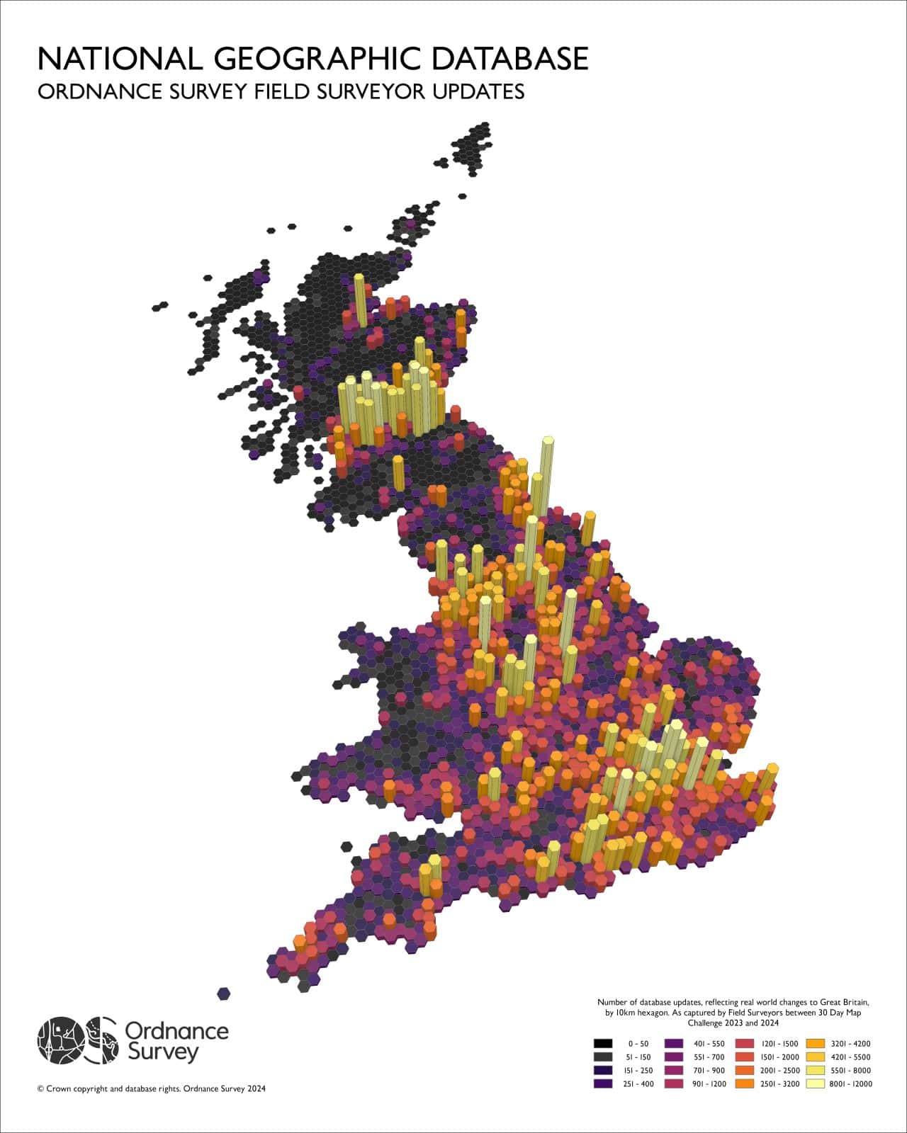
My job uses both human and physical geography. I lead survey and drone teams who map towns, roads, and buildings (the human geography), as well as rivers, hills, and coastlines (the physical geography). We collect data that becomes the detailed maps people use for navigation, planning, and understanding how places connect. I also review geographic data, like the map I made below, to see where surveyors have captured the most change across the country. That helps me plan future work and decide where we might need new surveyors to keep Great Britain’s maps accurate and up to date.

-
My Work:
I help lead teams of surveyors and drone pilots who map Britain’s buildings, roads, and landscapes. Our work helps keep national maps accurate so emergency services, councils, and businesses can find the right places quickly when it really matters.
-
Read more
I work for Ordnance Survey, the national mapping agency for Great Britain. Our job is make maps that show the country’s buildings, roads, rivers, and landscapes. I lead teams of managers, surveyors, and drone pilots who go and capture this map data, whether they are out in busy cities, or the countryside.
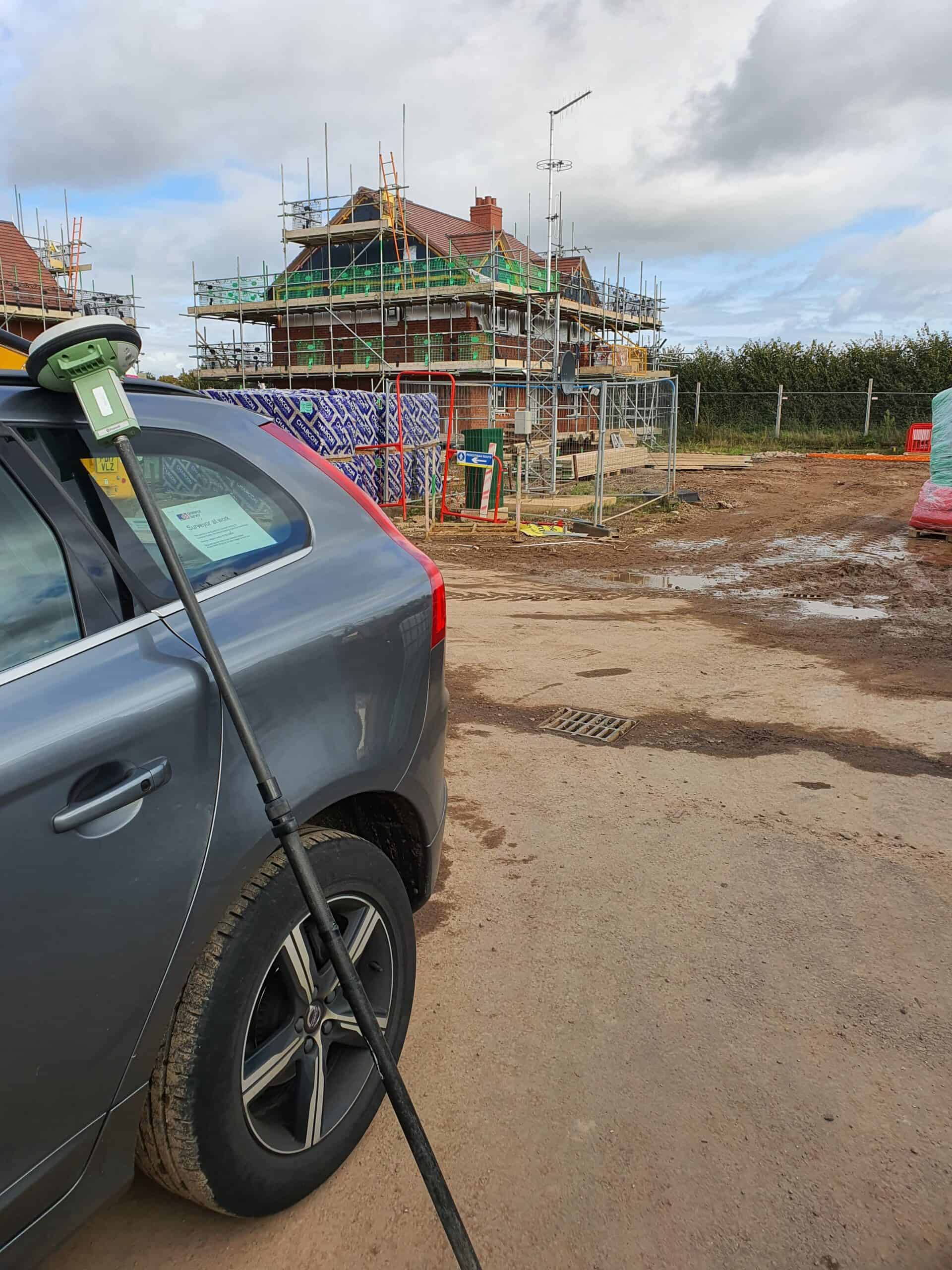
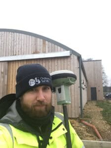
We use some amazing technology to make our maps, including drones and airplanes, (that capture detailed images that we can turn into maps), but also hand held GNSS recivers (poles that recieve satellite signals to locate the device to milimete accuracy).
Our maps include lots of different data that is used by all kinds of people; councils for planning bin routes, or school catchment areas, emergency services planning the fastest route to an incident, delivery drivers finding the right address, engineers building new roads and buildings, and even by mobile apps when you check directions on your phone.
My job is to make sure my teams work is planned safely, delivered on time, and meets the high accuracy standards needed to keep Great Britain’s maps up to date. See below for an example of some OS Open Map data (free, less detailed mapping that you can download from us):
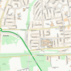
(Containts Ordnance Survey data, Crown copyright and database rights 2025)
-
My Typical Day:
I start the morning with the school run with my daughter before sitting down at my desk for 9 o’clock. Most of my day is spent in meetings with other managers and teams, making decisions to keep everything running smoothly, from planning survey work to checking that we’re collecting the right data in the right way. No two days are ever quite the same!
-
Read more
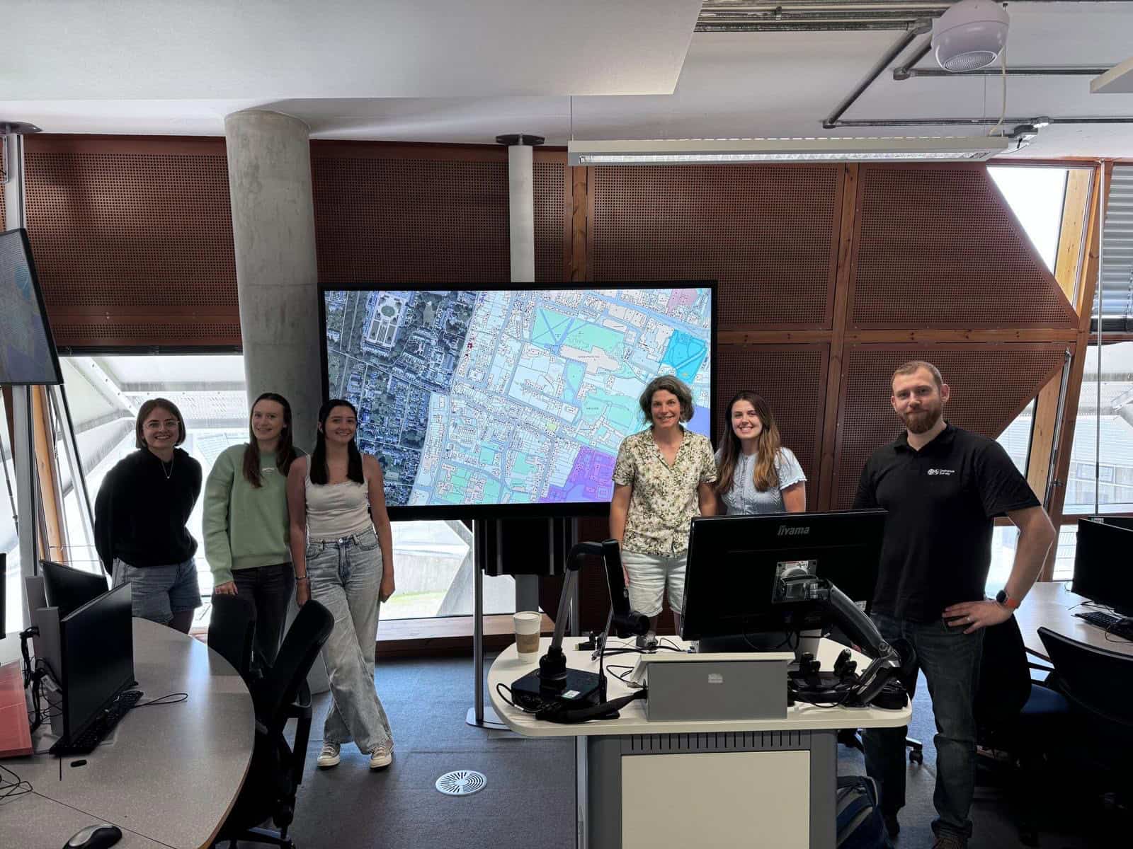
As a Senior Production Manager, a lot of my day is spent in meetings with other managers, or my survey and drone teams; I help plan work and make decisions to keep everything running smoothly. We talk about how and where our teams are working, what data we need to collect next, we check on progress and solve any problems that come up. Those problems can be equipment going wrong, people having problems with their cars, or the weather stopping us from flying the right jobs at the right time.
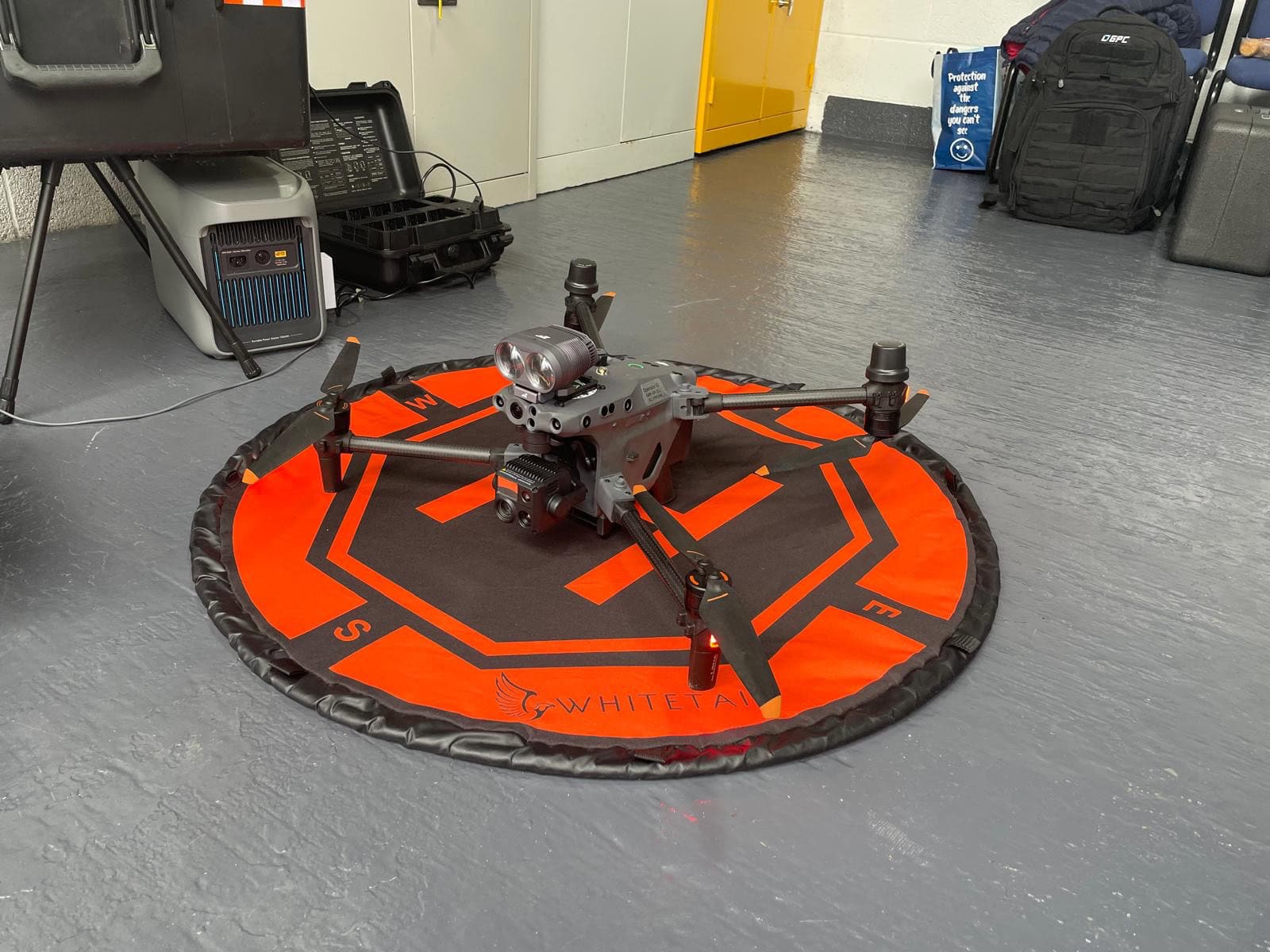
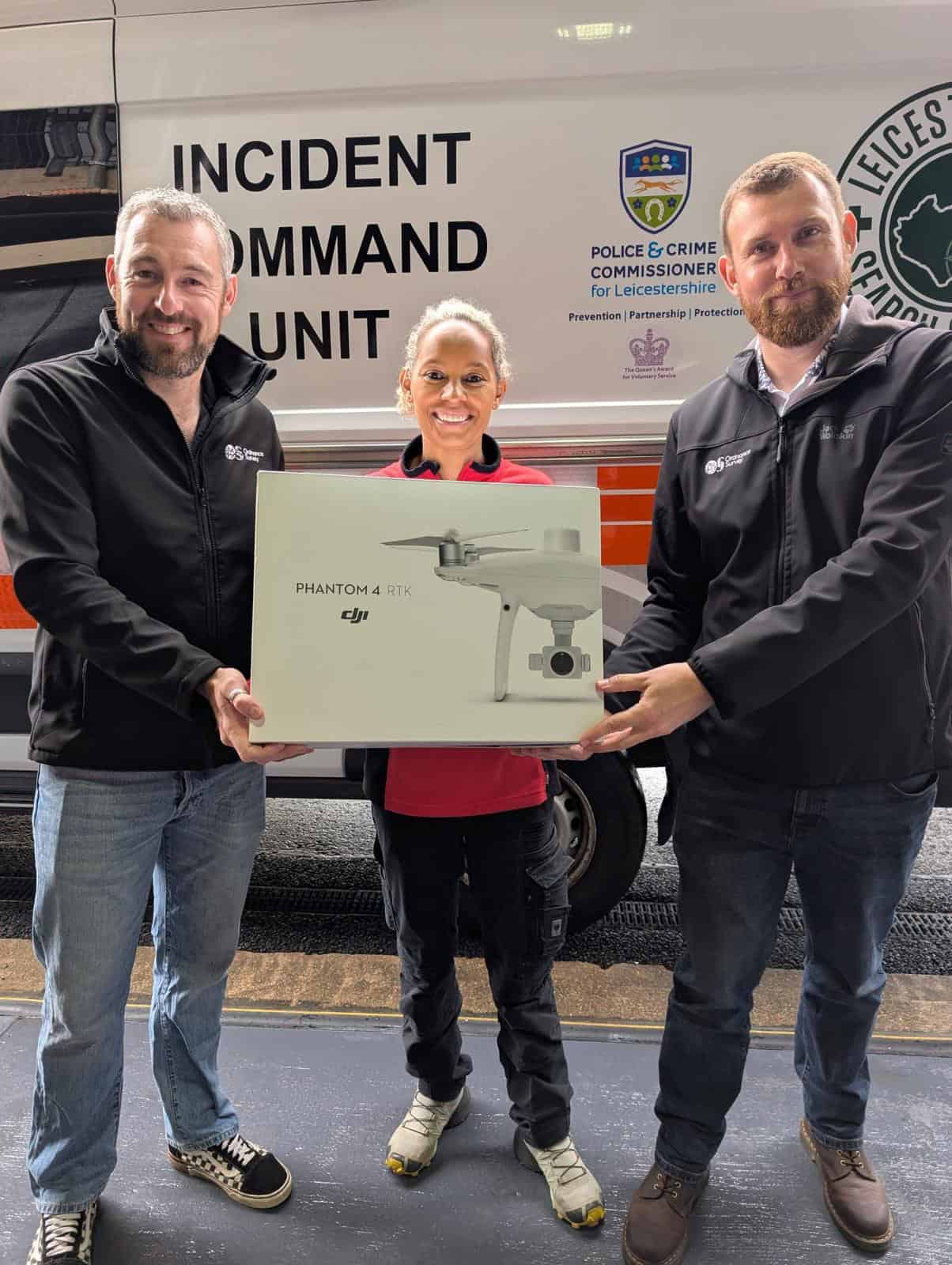
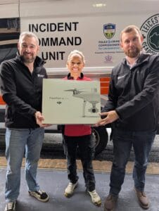
Every day’s a bit different, one moment we’re looking at at what needs to happen to deliver a new bit of map data, the next we’re discussing donating old drone to help charities:
While every day is different, each day is about making sure the work my teams do is helping keep Great Britain’s maps accurate and useful for everyone.
-
What I'd do with the prize money:
I’d use the prize money to buy a drone I could take to schools to run hands-on mapping workshops, letting students see real survey tools and see how geography, science, and technology come together to map the world around them.
-
Education:
I went to Southam School, in Warwickshire, where I completed my GCSEs and A-Levels.
-
Qualifications:
I have eight GCSEs (including Double Science, Double English, Maths, French, Geography, and Design & Technology) and four A-Levels (Biology, Mathematics, Physics, and General Studies).
I didn’t go to university, but later earned Chartered Geographer (Geographic Information Systems) accreditation with the Royal Geographical Society and Associate Membership of the Royal Institution of Chartered Surveyors. -
Work History:
My first proper job was with HM Land Registry, a government department that records who owns land and property in the UK. I started as a caseworker, checking legal documents and deeds to make sure each map showed the right land with the right property.
After that, I moved into surveying, which I loved as it was a much more hands-on role! I spent my days outdoors measuring buildings, fences, and kerbs to show their exact positions on maps and make sure everything matched what people actually owned.
I then joined Ordnance Survey, the national mapping agency. I began as a surveyor, mapping my local area using advanced tools such as theodolites and GNSS receivers:
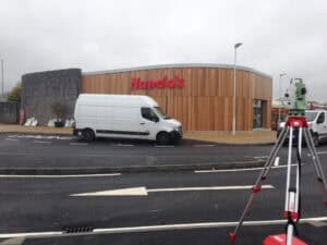
I worked outdoors in every kind of British weather, from freezing fog to bright sunshine, which made each day different and kept things interesting. After eight years, I became a Production Manager, leading a team of surveyors across South Yorkshire. My job was to plan and organise survey work, solve technical problems, and support my team to do their best work safely and accurately. It was a great mix of leadership, geography, and teamwork, no two days were ever the same.
-
Current Job:
Since November 2023, I’ve been a Senior Production Manager at Ordnance Survey, leading multiple survey and drone teams across Wales and the West of England.
-
Employer:
Ordnance Survey; the national mapping agency of Great Britain.
-
My Interview
-
How would you describe yourself in 3 words?
☕ tea-powered map manager
What did you want to be after you left school?
A criminal pathologist
Were you ever in trouble at school?
Yes, mostly for talking!
If you weren't doing this job, what would you choose instead?
I'd be working outside, probably back as a surveyor.
Who is your favourite singer or band?
At the moment I'm listening to a lot of an American rock band called The Gaslight Anthem.
What's your favourite food?
A proper Sunday roast dinner.
If you had 3 wishes for yourself what would they be? - be honest!
To retire to a quiet cottage in the Cotswolds or by the sea, with good coffee, happy family, and houseplants that finally survive.
Tell us a joke.
Why don’t skeletons fight each other? They don't have the guts....
-
Comments